| Namespace | http://www.opengis.net/ows/2.0 | |||
|
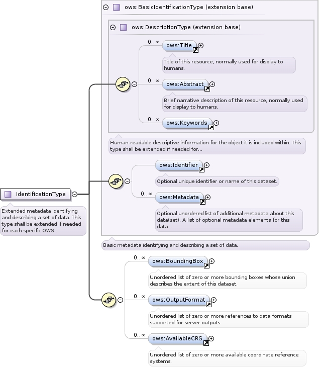
Annotations
|
|
|||
|
Diagram
|
 |
|||
| Type | ows:MimeType | |||
|
Properties
|
|
|||
|
Facets
|
|
|||
|
Used by
|
|
|||
|
Source
|
|