| Namespace | http://www.opengis.net/sld/1.2 | ||||||||||
|
Diagram
|
 |
||||||||||
| Type | sld:GetMapType | ||||||||||
|
Properties
|
|
||||||||||
| Model | |||||||||||
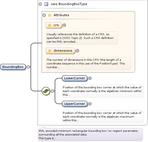
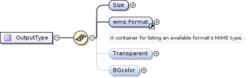
| Children | sld:BoundingBox, sld:CRS, sld:Elevation, sld:Exceptions, sld:Output, sld:StyledLayerDescriptor, sld:Time | ||||||||||
|
Instance
|
|
||||||||||
|
Attributes
|
|
||||||||||
|
Source
|
|