<element name="Format" type="string"><annotation><documentation>A container for listing an available format's MIME type.</documentation></annotation></element>
Element wms:WMS_Capabilities
Namespace
http://www.opengis.net/wms
Annotations
A WMS_Capabilities document is returned in response to aGetCapabilities request made on a WMS.
<element name="WMS_Capabilities"><annotation><documentation>A WMS_Capabilities document is returned in response to a GetCapabilities request made on a WMS.</documentation></annotation><complexType><sequence><element ref="wms:Service"/><element ref="wms:Capability"/></sequence><attribute name="version" type="string" fixed="1.3.0"/><attribute name="updateSequence" type="string"/></complexType></element>
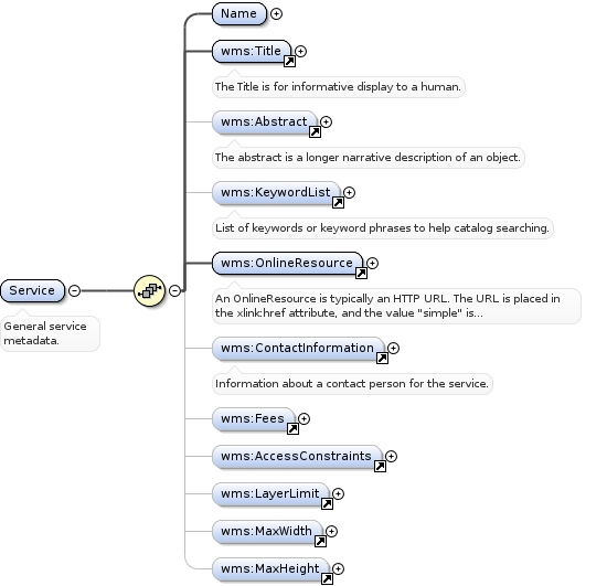
<element name="Abstract" type="string"><annotation><documentation>The abstract is a longer narrative description of an object.</documentation></annotation></element>
Element wms:KeywordList
Namespace
http://www.opengis.net/wms
Annotations
List of keywords or keyword phrases to help catalog searching.
<element name="KeywordList"><annotation><documentation>List of keywords or keyword phrases to help catalog searching.</documentation></annotation><complexType><sequence><element ref="wms:Keyword" minOccurs="0" maxOccurs="unbounded"/></sequence></complexType></element>
<element name="Keyword"><annotation><documentation>A single keyword or phrase.</documentation></annotation><complexType><simpleContent><extension base="string"><attribute name="vocabulary" type="string"/></extension></simpleContent></complexType></element>
Element wms:OnlineResource
Namespace
http://www.opengis.net/wms
Annotations
An OnlineResource is typically an HTTP URL. The URL is placed inthe xlink:href attribute, and the value "simple" is placed in thexlink:type attribute.
<element name="OnlineResource"><annotation><documentation>An OnlineResource is typically an HTTP URL. The URL is placed in the xlink:href attribute, and the value "simple" is placed in the xlink:type attribute.</documentation></annotation><complexType><attributeGroup ref="xlink:simpleAttrs"/></complexType></element>
Element wms:ContactInformation
Namespace
http://www.opengis.net/wms
Annotations
Information about a contact person for the service.
<element name="ContactInformation"><annotation><documentation>Information about a contact person for the service.</documentation></annotation><complexType><sequence><element ref="wms:ContactPersonPrimary" minOccurs="0"/><element ref="wms:ContactPosition" minOccurs="0"/><element ref="wms:ContactAddress" minOccurs="0"/><element ref="wms:ContactVoiceTelephone" minOccurs="0"/><element ref="wms:ContactFacsimileTelephone" minOccurs="0"/><element ref="wms:ContactElectronicMailAddress" minOccurs="0"/></sequence></complexType></element>
A Capability lists available request types, how exceptions may bereported, and whether any extended capabilities are defined.It also includes an optional list of map layers available from thisserver.
<element name="Capability"><annotation><documentation>A Capability lists available request types, how exceptions may be reported, and whether any extended capabilities are defined. It also includes an optional list of map layers available from this server.</documentation></annotation><complexType><sequence><element ref="wms:Request"/><element ref="wms:Exception"/><element ref="wms:_ExtendedCapabilities" minOccurs="0" maxOccurs="unbounded"/><element ref="wms:Layer" minOccurs="0"/></sequence></complexType></element>
Element wms:Request
Namespace
http://www.opengis.net/wms
Annotations
Available WMS Operations are listed in a Request element.
<element name="DCPType"><annotation><documentation>Available Distributed Computing Platforms (DCPs) are listed here. At present, only HTTP is defined.</documentation></annotation><complexType><sequence><element ref="wms:HTTP"/></sequence></complexType></element>
Element wms:HTTP
Namespace
http://www.opengis.net/wms
Annotations
Available HTTP request methods. At least "Get" shall be supported.
<element name="HTTP"><annotation><documentation>Available HTTP request methods. At least "Get" shall be supported.</documentation></annotation><complexType><sequence><element ref="wms:Get"/><element ref="wms:Post" minOccurs="0"/></sequence></complexType></element>
<element name="Exception"><annotation><documentation>An Exception element indicates which error-reporting formats are supported.</documentation></annotation><complexType><sequence><element ref="wms:Format" maxOccurs="unbounded"/></sequence></complexType></element>
Element wms:_ExtendedCapabilities
Namespace
http://www.opengis.net/wms
Annotations
Individual service providers may use this element to report extendedcapabilities.
<element name="_ExtendedCapabilities" abstract="true"><annotation><documentation>Individual service providers may use this element to report extended capabilities.</documentation></annotation></element>
Element wms:Layer
Namespace
http://www.opengis.net/wms
Annotations
Nested list of zero or more map Layers offered by this server.
<element name="Name" type="string"><annotation><documentation>The Name is typically for machine-to-machine communication.</documentation></annotation></element>
Element wms:CRS
Namespace
http://www.opengis.net/wms
Annotations
Identifier for a single Coordinate Reference System (CRS).
<element name="CRS" type="string"><annotation><documentation>Identifier for a single Coordinate Reference System (CRS).</documentation></annotation></element>
Element wms:EX_GeographicBoundingBox
Namespace
http://www.opengis.net/wms
Annotations
The EX_GeographicBoundingBox attributes indicate the limits of the enclosingrectangle in longitude and latitude decimal degrees.
<element name="EX_GeographicBoundingBox"><annotation><documentation>The EX_GeographicBoundingBox attributes indicate the limits of the enclosing rectangle in longitude and latitude decimal degrees.</documentation></annotation><complexType><sequence><element name="westBoundLongitude" type="wms:longitudeType"/><element name="eastBoundLongitude" type="wms:longitudeType"/><element name="southBoundLatitude" type="wms:latitudeType"/><element name="northBoundLatitude" type="wms:latitudeType"/></sequence></complexType></element>
<element name="Dimension"><annotation><documentation>The Dimension element declares the existence of a dimension and indicates what values along a dimension are valid.</documentation></annotation><complexType><simpleContent><extension base="string"><attribute name="name" type="string" use="required"/><attribute name="units" type="string" use="required"/><attribute name="unitSymbol" type="string"/><attribute name="default" type="string"/><attribute name="multipleValues" type="boolean"/><attribute name="nearestValue" type="boolean"/><attribute name="current" type="boolean"/></extension></simpleContent></complexType></element>
Element wms:Attribution
Namespace
http://www.opengis.net/wms
Annotations
Attribution indicates the provider of a Layer or collection of Layers.The provider's URL, descriptive title string, and/or logo image URLmay be supplied. Client applications may choose to display one ormore of these items. A format element indicates the MIME type ofthe logo image located at LogoURL. The logo image's width and heightassist client applications in laying out space to display the logo.
<element name="Attribution"><annotation><documentation>Attribution indicates the provider of a Layer or collection of Layers. The provider's URL, descriptive title string, and/or logo image URL may be supplied. Client applications may choose to display one or more of these items. A format element indicates the MIME type of the logo image located at LogoURL. The logo image's width and height assist client applications in laying out space to display the logo.</documentation></annotation><complexType><sequence><element ref="wms:Title" minOccurs="0"/><element ref="wms:OnlineResource" minOccurs="0"/><element ref="wms:LogoURL" minOccurs="0"/></sequence></complexType></element>
A Map Server may use zero or more Identifier elements to list IDnumbers or labels defined by a particular Authority. For example,the Global Change Master Directory (gcmd.gsfc.nasa.gov) defines aDIF_ID label for every dataset. The authority name and explanatoryURL are defined in a separate AuthorityURL element, which may bedefined once and inherited by subsidiary layers. Identifiersthemselves are not inherited.
<element name="AuthorityURL"><annotation><documentation>A Map Server may use zero or more Identifier elements to list ID numbers or labels defined by a particular Authority. For example, the Global Change Master Directory (gcmd.gsfc.nasa.gov) defines a DIF_ID label for every dataset. The authority name and explanatory URL are defined in a separate AuthorityURL element, which may be defined once and inherited by subsidiary layers. Identifiers themselves are not inherited.</documentation></annotation><complexType><sequence><element ref="wms:OnlineResource"/></sequence><attribute name="name" type="NMTOKEN" use="required"/></complexType></element>
A Map Server may use zero or more MetadataURL elements to offerdetailed, standardized metadata about the data underneath aparticular layer. The type attribute indicates the standard to whichthe metadata complies. The format element indicates how the metadata is structured.
<element name="MetadataURL"><annotation><documentation>A Map Server may use zero or more MetadataURL elements to offer detailed, standardized metadata about the data underneath a particular layer. The type attribute indicates the standard to which the metadata complies. The format element indicates how the metadata is structured.</documentation></annotation><complexType><sequence><element ref="wms:Format"/><element ref="wms:OnlineResource"/></sequence><attribute name="type" type="NMTOKEN" use="required"/></complexType></element>
Element wms:DataURL
Namespace
http://www.opengis.net/wms
Annotations
A Map Server may use DataURL offer a link to the underlying data representedby a particular layer.
<element name="DataURL"><annotation><documentation>A Map Server may use DataURL offer a link to the underlying data represented by a particular layer.</documentation></annotation><complexType><sequence><element ref="wms:Format"/><element ref="wms:OnlineResource"/></sequence></complexType></element>
Element wms:FeatureListURL
Namespace
http://www.opengis.net/wms
Annotations
A Map Server may use FeatureListURL to point to a list of thefeatures represented in a Layer.
<element name="FeatureListURL"><annotation><documentation>A Map Server may use FeatureListURL to point to a list of the features represented in a Layer.</documentation></annotation><complexType><sequence><element ref="wms:Format"/><element ref="wms:OnlineResource"/></sequence></complexType></element>
Element wms:Style
Namespace
http://www.opengis.net/wms
Annotations
A Style element lists the name by which a style is requested and ahuman-readable title for pick lists, optionally (and ideally)provides a human-readable description, and optionally gives a styleURL.
<element name="Style"><annotation><documentation>A Style element lists the name by which a style is requested and a human-readable title for pick lists, optionally (and ideally) provides a human-readable description, and optionally gives a style URL.</documentation></annotation><complexType><sequence><element ref="wms:Name"/><element ref="wms:Title"/><element ref="wms:Abstract" minOccurs="0"/><element ref="wms:LegendURL" minOccurs="0" maxOccurs="unbounded"/><element ref="wms:StyleSheetURL" minOccurs="0"/><element ref="wms:StyleURL" minOccurs="0"/></sequence></complexType></element>
Element wms:LegendURL
Namespace
http://www.opengis.net/wms
Annotations
A Map Server may use zero or more LegendURL elements to provide animage(s) of a legend relevant to each Style of a Layer. The Formatelement indicates the MIME type of the legend. Width and heightattributes may be provided to assist client applications in laying outspace to display the legend.
<element name="LegendURL"><annotation><documentation>A Map Server may use zero or more LegendURL elements to provide an image(s) of a legend relevant to each Style of a Layer. The Format element indicates the MIME type of the legend. Width and height attributes may be provided to assist client applications in laying out space to display the legend.</documentation></annotation><complexType><sequence><element ref="wms:Format"/><element ref="wms:OnlineResource"/></sequence><attribute name="width" type="positiveInteger"/><attribute name="height" type="positiveInteger"/></complexType></element>
Element wms:StyleSheetURL
Namespace
http://www.opengis.net/wms
Annotations
StyleSheeetURL provides symbology information for each Style of a Layer.
<element name="StyleSheetURL"><annotation><documentation>StyleSheeetURL provides symbology information for each Style of a Layer.</documentation></annotation><complexType><sequence><element ref="wms:Format"/><element ref="wms:OnlineResource"/></sequence></complexType></element>
Element wms:StyleURL
Namespace
http://www.opengis.net/wms
Annotations
A Map Server may use StyleURL to offer more information about thedata or symbology underlying a particular Style. While the semanticsare not well-defined, as long as the results of an HTTP GET requestagainst the StyleURL are properly MIME-typed, Viewer Clients andCascading Map Servers can make use of this. A possible use could beto allow a Map Server to provide legend information.
<element name="StyleURL"><annotation><documentation>A Map Server may use StyleURL to offer more information about the data or symbology underlying a particular Style. While the semantics are not well-defined, as long as the results of an HTTP GET request against the StyleURL are properly MIME-typed, Viewer Clients and Cascading Map Servers can make use of this. A possible use could be to allow a Map Server to provide legend information.</documentation></annotation><complexType><sequence><element ref="wms:Format"/><element ref="wms:OnlineResource"/></sequence></complexType></element>
Element wms:MinScaleDenominator
Namespace
http://www.opengis.net/wms
Annotations
Minimum scale denominator for which it is appropriate todisplay this layer.
<element name="MinScaleDenominator" type="double"><annotation><documentation>Minimum scale denominator for which it is appropriate to display this layer.</documentation></annotation></element>
Element wms:MaxScaleDenominator
Namespace
http://www.opengis.net/wms
Annotations
Maximum scale denominator for which it is appropriate todisplay this layer.
<element name="MaxScaleDenominator" type="double"><annotation><documentation>Maximum scale denominator for which it is appropriate to display this layer.</documentation></annotation></element>
Complex Type wms:OperationType
Namespace
http://www.opengis.net/wms
Annotations
For each operation offered by the server, list the available outputformats and the online resource.
<complexType name="OperationType"><annotation><documentation>For each operation offered by the server, list the available output formats and the online resource.</documentation></annotation><sequence><element ref="wms:Format" maxOccurs="unbounded"/><element ref="wms:DCPType" maxOccurs="unbounded"/></sequence></complexType>